 Sun, May 20, 1917 – Page 48 · Oakland Tribune (Oakland, California) · Newspapers.com
 |
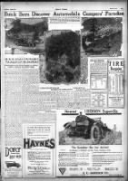
| Buick car party on the scenic route traversing the early day mining region of Sierra County, where the mountains are filled with gold and the North Fork of the Yuba river teems with the gamey trout. A vacation land ideal for the camper who seeks to get away from the beaten trails. |
BUICK BOYS EXPLORE TRAILS OF PIONEERS
Wonderlands of the Sierra Located in Mining Country of Days of '49; Good Fishing
Imagine if you can, Mr., Miss or Mrs. Motorist, a country where the mountains are filled with gold, the streams with big gamey trout and the atmosphere full of scenery. Connect this picture with the outside world by roads that are not impassable to the average automobile, and you have vacation possibilities that are sure to interest many of the bolder and more adventurous motorists. Sierra county, of which Downieville is the county seat, fills the above description, and within the next few years this little known district will take its place among the well-known vacation spots of California. At least this is the opinion of C. A. Magee of the Howard Automobile Company, Pacific Coast distributors of Buick cars, who has just returned from a ten-day trip in one of the small four-cylinder Buick touring cars, which took him and a party of friends to the very heart of this district.
In speaking of the trip, McGee has the Following to say:
"There is hardly a motorist in California who is not more or less familiar with the Auburn-Emigrant Gap State road and the Placerville State road to Lake Tahoe and the East. Tioga Pass between Yosemite and Mono lake is likewise well known, as is the Quincy-Beckwith Pass road between Oroville and Nevada. [I'm most of the way through reading The Life and Adventures of James P. Beckwourth, Mountaineer, Scout, and Pioneer, and Chief of the Crow Nation of Indians right now. Absolutely worth your time. I want to ride the Beckwourth Trail on my bicycle. -MF] Ask any of them, however, where Downieville or Sierra City is and the chances are ninety-nine out of a hundred will not be able to tell you. These are the principal towns in the western part of Sierra county and are both located on the north fork of the Yuba river. In the early days of California they were much better known than at present, and the natives of Downieville, the county seat, point with pride to their county court house, which was built in 1855. The sole occupation of the country tributary to these two towns is mining, and a visit to them will give one some idea of what California was like in the early sixties. The prospector with his grub-stake packed on a burro is a familiar sight on the streets of these two old mining towns. Most of the buildings are such as are described by Bret Harte in his stories of early California, The streets also conform to his idea of what mining town streets should be. In the stores scales used for weighing gold dust and nuggets hang on the sides of the cash registers, and an occasional sawed-off shotgun is still in evidence as a memento of the past... The bold bad man of other days, however, is no more.
"The route we followed seems to be the popular one and is as follows: San Francisco to Sacramento via Oakland, Martinez, Vacaville and the Causeway, then on through Roseville, Rocklin, Loomis, Penryn, Newcastle to Auburn. Here we left the Auburn-Emigrant Gap Road to Lake Tahoe and turned north to Grass Valley, Nevada City, North San Juan and Camptonville, then northeast to Mountain House, Goodyear Bar and Downieville, then east to Sierra City. The approximate distances are: San Francisco to Sacramento, 100 miles; Sacramento to Auburn, 35 miles; Auburn to Grass Valley, 26; Grass Valley to Nevada City, 4; Nevada City to North San Juan, 13; North San Juan to Camptonville, 10; Camptonville to Goodyear Bar, 17; Goodyear Bar to Downieville, 4; Downieville to Sierra City, 13.
 |
| 1917 Automobile highway map of California and western Nevada viewable in georeferencer.com |
"Our Buick was the first car to arrive in Downieville in 1917, and for that reason we saw the roads in their worst possible condition. San Francisco to Auburn is practically all highway; Auburn to Nevada City is good natural road. Nevada City to five miles north of Camptonville is mostly yellow clay, and when one encounters this road with an automobile directly after thirty-six hours of heavy rain, as we did, they can rest assured that their car has some real work ahead of it. The worst grades on the entire trip are found in this same piece of road, which crosses the three ranges of mountains separating the south, middle and north forks of the Yuba river, The worst of these grades and the one that gave us the most trouble is known as the Mountain House grade, and is between Camptonville and Downieville. The clay mud was so bad on this grade that one of the party had to clean the mud from the wheels every few yards, as they would cake in so solid that each wheel would weight 400 or 600 pounds, and the skid chains and non-skid tires would completely disappear.
"Imagine, if you can, driving a car up 20 per cent grades with roads in this condition. The Buick never failed us, however, and continued to plow through the mud and slush hour after hour, and when we finally got out of the clay country which was in the vicinity of Goodyear Bar and started up over the really good road along the north fork of the Yuba river, it ran as smoothly as though it were making a demonstration on the paved streets of San Francisco. The Mountain House grade, which has always been a stumbling block to automobile travel between the Sacramento valley and Sierra county, will be eliminated within the next few months. The State has an honor gang of convicts constructing a new road down the river from Goodyear Bar to Camptonville. This road will have a 6 per cent maximum grade and will make Downieville accessible to automobiles every month in the year.
 |
| A typical convict labor scene on the California Highway system. |
"On this trip the scenery starts as soon as one is a few miles east of Sacramento and continues to improve with every mile traveled. The most spectacular bit of scenery is the Sierra Buttes, which are directly north of Sierra City. These buttes are very rugged and their summit is more than 4000 feet above the city which takes its name from them.
"The roads east of this point were blocked with snow when we were there. We learned, however, that five miles east of Sierra City the road branches, one following on up the north fork of the Yuba and crossing Yuba Pass into Sierra valley, where one may turn either north or south to one of the well-known roads to Reno. The other turns north, passes Gold lake and connects with the Oroville-Quincy route at Blairsden on the Western Pacific railroad."
 |
| Detail of 1917 Automobile highway map of California and western Nevada |
No comments:
Post a Comment