I usually like to do '
then and now' posts about these old postcards, but
this one is tough, because the vantage point of the photographer is now under about 10-20' of earth, and above that earth is a PG&E electric substation that is off-limits.
 |
| Fast Electric Train, "The Comet," Crossing Lake Temescal; O. A. & E. Ry. |
 |
Going to Sacramento?
Ride in comfort. Observation Cars. Fast Electric Trains. Block signals all the way. Through trains from San Francisco and Oakland to Marysville, Colusa, Oriville, and Chico.
OAKLAND, ANTIOCH, & EASTERN RAILWAY |
I never understood exactly where these trestles were, because I ride the "Landvale Station Trail" bike path on my bicycle, and I don't go over water. The photographer would have been standing on the northern bank of Temescal creek, where it fed the dammed Lake Temescal, facing south, looking at the ridge over which is Contra Costa road. That spot is now within the PG&E substation, where I can't go to take this picture. Here's a rough equivalent:
 |
This view is from google maps, with Satellite 3D view on, rotated to view the lake and southern shore approximately (zoomed out a bit) where the postcard photograph would have been taken. The rails-to-trails bike path is out of view, in front of the viewer. I will try to snap a pic from a bike ride to show it as well.
|
 |
This is my best attempt at getting a photo from the same approximate location, now. I'm standing south of the PG&E station, about 30' north of the bike path / railroad alignment. That's my wife, waiting for me to take the picture, and I'm looking SSW, roughly the same direction as the original photo. The ground you see, that I'm standing on is all fill over the original Temescal Canyon. What a difference from then to now!
|
Next, you can see how, in
1915 and 1942 USGS maps, the lake's northern arm is filled in with earth, and the need for a trestle goes away:
I was not able to find much about this change, in the newspapers. Here are some clues:
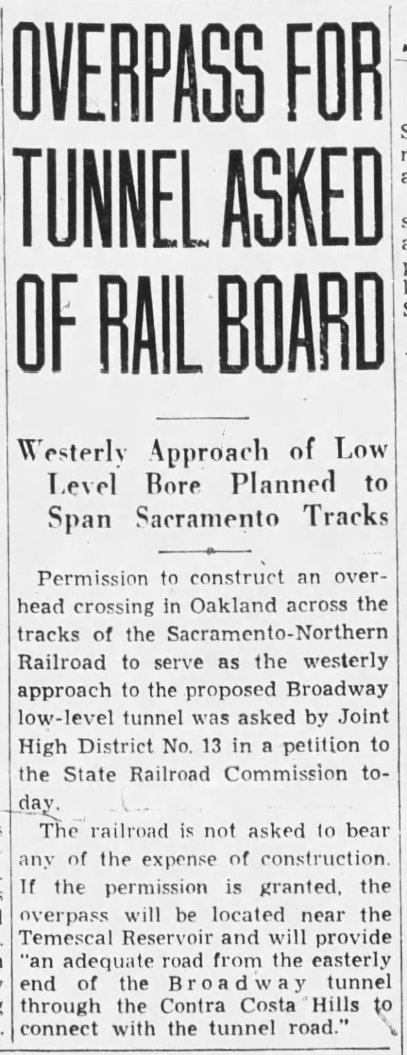 OVERPASS FOR TUNNEL ASKED OF RAIL BOARD Fri, Feb 16, 1934 – Page 21 · Oakland Tribune (Oakland, California) · Newspapers.com
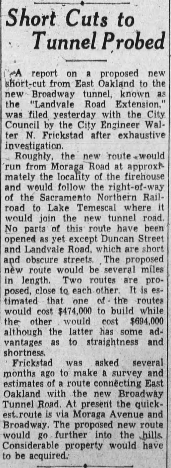 Short Cuts to Tunnel Probed Tue, Jan 1, 1935 – Page 17 · Oakland Tribune (Oakland, California) · Newspapers.com
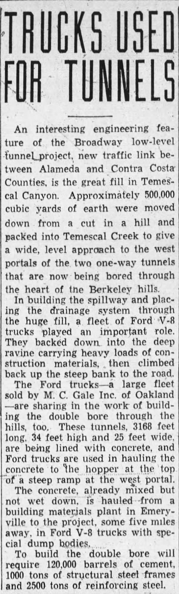 Earth from Caldecott Tunnel bores used to fill Temescal Creek drainage Sun, Feb 3, 1935 – Page 73 · Oakland Tribune (Oakland, California) · Newspapers.com
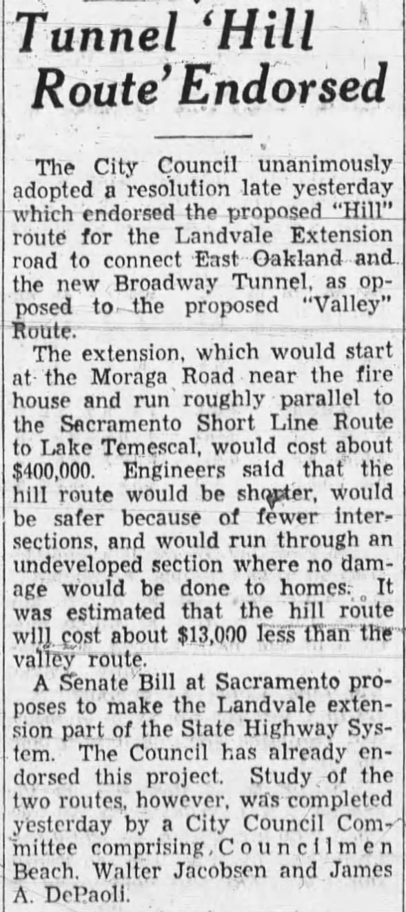 Tunnel 'Hill Route' Endorsed
Montclair to Caldecott road
Temescal Landvale Wed, Apr 10, 1935 – Page 9 · Oakland Tribune (Oakland, California) · Newspapers.com
Tunnel 'Hill Route' Endorsed
Montclair to Caldecott road
Temescal Landvale Wed, Apr 10, 1935 – Page 9 · Oakland Tribune (Oakland, California) · Newspapers.com
 LAKE TEMESCAL HIGHWAY URGED Fri, May 3, 1935 – Page 12 · Oakland Tribune (Oakland, California) · Newspapers.com


Comments
Post a Comment