 1969 May 24th Redwood walk and history Sat, May 24, 1969 – Page 23 · Oakland Tribune (Oakland, Alameda, California, United States of America) · Newspapers.com
WEEKEND WALK
Redwood Canyon Cool, Alluring
By DON and PHILA WITHERELL
Breezy ridges, broadleaf forests and a cool canyon filled with ferns and redwoods are among the diverse delights which await the hiker in Redwood Regional Park. The park, located in the hills east of Oakland, has an interesting history and a network of well-marked trails to satisfy the most discriminating weekend walker.This walk, a two and one-half mile circuit, begins at the Skyline entrance at the north end. You may reach Skyline Boulevard from Warren Freeway via the Joaquin Miller Road exit. Follow Joaquin Miller Road to Skyline Boulevard, turn left and continue about two miles past the Roberts Recreation area until you see the Skyline Gate sign and parking area. Begin by taking the trail to the left which is marked East Ridge Trail.
The first mile of the trail follows a ridge, leisurely descending through a mixed forest of small Eucalyptus, mostly Red Gum and Monterey Pine. Both of these trees have been introduced from other places. However they are such a prominent feature of the East Bay Hills that they must be considered as important forest communities in their own right.
Growing along the roadway are a number of plants that bloom in late spring. The Cow Parsnip, with its large leaves and numerous white flowers in umbels (a broad flat-topped cluster) is at its peak now. The plants, four to five feet high, prefer northern exposure, facing slopes or the brushy places which are prevalent along this section of the trail.
Indians, who previously inhabited the area relished the tender shoots that appear in early spring.
Brightening the roadway itself is the beautiful Sun-cup. Its profuse gold blooms rise from an improbable base of weedy-looking leaves that grow prostrate to the soil.
Blooming, too, are the sprawling wild cucumber and the omnipresent blackberry which grows in tangled thickets and in summer produces the succulent fruits sought after by birds and hikers.
Although there are occasional views through the trees of Mt Diablo, with the hills above Moraga Valley in the foreground, and glimpses over Redwood Canyon to its richly clad slopes, the real panorama is reserved for the area viewed shortly before the Mill Trail tumoff. [Now "Canyon Trail" - MF]
At this point the groves of Eucalyptus and Pine are left behind and you have a clear view from the ridge to all directions Ahead, the trail, a pale ribbon that rises and then disappears, ends three miles beyond at Pinehurst Road at the park's south end. Take the Mill Trail, which is marked with a green park sign, and follow the trail as it descends steeply into the canyon to your right.
Dense stands of Live Oak and Madrone shade the roadway, their wonderfully curved limbs and trunks rising out of a lush understory of woodland plants. The Madrone is perhaps the handsomest tree in this broadleaf forest with its finely sculpted red limbs and thick glossy leaves. You may still see a few flowers, white waxen bells shaped like diminutive lanterns. The limbs carry clusters of new leaves now and the old scarred leaves ravaged by a year of seasons will turn cinnamon and drop off to carpet the forest floor. Listen for the staccato drumming ot the Acorn Woodpecker as he embellishes an oak trunk with round holes.
At the bottom of the canyon, Mill Trail intersects Stream Trail. Turn right and begin the homeward portion of the loop which will bring you through a stand of second growth Redwood. This is a dimly-lighted canyon, redolent with the odor of humus, where silence is enriched by the languid sounds of a small stream and the ascending flute-song of the reclusive Swainson's Thrush.
Luxuriant ferns crowd the steep slopes above the stream. The graceful Hazel Bush lends a lighthearted delicacy to the somber shade. The thin-toothed leaves are arranged on slender limbs in a horizontal manner enabling them to capture the meager light that filters through the trees.
[Go read this for much more background on the next two paragraphs. - MF]
 |
| The Forgotten Redwoods of the East Bay, by Sherwood D. Burgess, California Historical Society quarterly, Vol. 1-40, 1922-61. 1 v |
Imagine, if you can, that in this place once grew great redwoods that equaled or perhaps surpassed in size the giants of the north coast. Ships entering the Golden Gate in the early days used these lofty spires as a navigational aid. With the Gold Rush came a sudden increase in population and the demand for housing.
The San Antonio Redwoods, as this grove was called, fell before the saw. The lumber was used to help build San Francisco and then later Benicia. Mission San Jose and other communities. By I860 only stumps remained. Not a single tree had been spared for posterity.
The trail climbs out of the canyon bringing you once again into the mixed environment of chaparral, grassland and woodland. Birds, which seem to prefer the forest edges rather than their dense interior, are again prevalent and in fine voice.
To the left close to the trail grow several groups of Horsetail Rushes. They are what botanists call prehistoric endemics, or plants left over from a distant era. Once they grew 40 feet high forming forests that in their decay were important contributors to the coal beds. About a half mile before the trail ends you will pass through a girls' camp. Available there are water, picnic tables and restrooms. A final uphill wack brings you back to the parking area.
If you are curious about the plants that grow here in varied abundance you will enjoy two field guides both published by the University of California Press costing $1.50 each. They are "Native Trees of the San Francisco Bay Region" by Metcalf, and "Native Shrubs of the San Francisco Bay Region" by Ferris.

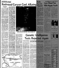
Here's the map from the article, georeferenced on actual map data, transparent so you can see the underlying map. Note that "Mill Trail" is now called "Canyon Trail", and the bottom was re-routed when the parking lot was built. The trail in the middle of the map is "Eucalyptus".


Comments
Post a Comment