Boundary Line Between Alameda and Contra Costa - Daily Alta California, Volume 29, Number 10060, 24 October 1877
New May 2, 2020, just added, these two articles:
 Castro's Party. Redwood Park Prince and Brown mills survey of Alameda and
Contra Costa counties
Fri, Oct 12, 1877 – Page 3 · Oakland Tribune (Oakland, California) ·
Newspapers.com
Castro's Party. Redwood Park Prince and Brown mills survey of Alameda and
Contra Costa counties
Fri, Oct 12, 1877 – Page 3 · Oakland Tribune (Oakland, California) ·
Newspapers.comCastro's Party.
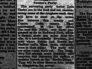
The surveying party under Luis Castro are in the field and are encountering some of the roughest work they will have to meet on the entire line between this county and Contra Costa county. They commenced at the bay shore line near San Pablo, and have progressed as far as Redwood Peak, which is distant some ten miles from this city, in northeasterly direction, and near where Prince and Brown had lumber mills when those redwoods were in their prime. The party will see some rough work yet. The boundary line crosses some fearfully wild canyons, and traverses the section of country known as the "Rocky Ridge." They will be some three or four weeks in completing the survey.
[Jose Luis del Refugio Castro
was the grandson of
Luis Maria Peralta,
whose Spanish land grant,
Rancho San Antonio
later became much of
Alameda County. His mother was
Doña María Luisa Fermina Bárbara Peralta, and his father,
Guillermo Castro
is the namesake of
Castro Valley, and his
Rancho San Lorenzo
the town of
San Lorenzo. - MF]
 The County Line Survey. TO BLOG First mention of Redwood Peak Wed,
Oct 24, 1877 – Page 3 · Oakland Tribune (Oakland, California) ·
Newspapers.com
The County Line Survey.
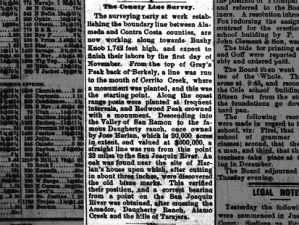
The surveying party at work establishing the boundary line between Alameda and Contra Costa counties, are now working along towards Bushy Knob 1,742 feet high, and expect to finish their labors by the first day of November. From the top of Gray's Peak back of Berkeley, a line was run to the mouth of Cerrito Creek, where a monument was planted, and this was the starting point. Along the coast range posts were planted at frequent intervals, and Redwood Peak crowned with a monument. Descending into the Valley of San Ramon to the famous Daugherty [Dougherty] ranch, once owned by Jose Harlan, which is 20,000 acres in extent, and valued at $600,000, a straight line was run from this point 23 miles to the San Joaquin River. An oak was found near the site of Harlan's house upon which, after cutting in about three inches, were discovered the old blaze marks. This verified their position, and a correct bearing from a point on the San Joaquin River was obtained, after crossing the Amador, Daugherty Ranch, Alamo Creek and the hills of Tarajera. [sic]
Daily Alta California, Volume 29, Number 10060, 24 October 1877
Boundary Line Between Alameda and Contra Costa.
Twenty years have elapsed since the boundary lines between Contra Costa and Alameda counties were established, and very many of the landmarks and monuments have become obliterated. This has caused considerable litigation and the Assessors of the several counties much trouble to know in which county a man was to be assessed and pay his taxes. Often, when the Contra Costa Assessor would be making his rounds, tax-payers would produce receipts from Alameda's Assessor, and vice versa. Thus was the county most benefited whose county seat was most convenient to a large number along and near the supposed boundary line, which was so indefinite as to be an accepted excuse in many cases where it was questionable to which county should receive taxes. Alameda County, therefore, was most favored, as Oakland, the county seat, was more convenient than Martinez, the county seat of Contra Costa, for these reasons, and others, the Supervisors of the two counties appointed a Commission consisting of the County Surveyor of their respective counties, the Surveyor-General to be arbiter in case of disagreement, to run a new line and place permanent monuments as nearly as possible on the original survey of Horace A. Higley in 1856, which was adopted by the Code, and reads as follows: "By Act of Legislature in 1856, the boundary line between Alameda and Contra Costa counties was established as follows, to wit: Commencing at the slough known as the Pescadero, being the west channel of old San Joaquin river; thence westerly in a straight line until it strikes the dividing ridge in the direction of the house of José Harlan, [1] in Amador valley;thence westerly along said ridge, crossing the gulch one half mile below Prince's mill;

|
| westerly from Amador Valley to one half mile below Prince's Mill |

|
| Prince's Brown's mills |
thence to and running upon the dividing ridge between the redwoods known as
the San Antonio and Prince's woods; thence along said ridge to the head of the
gulch or creek (Cerrito Creek), that divides the ranches of the Peraltas
from the San Pablo ranches; thence down said gulch to its mouth on the Bay," a
distance of 60 to 75 miles.

|
| upon the dividing ridge between San Antonio and Prince's woods to the head of Cerritos Creek |
According to an agreed plan a party of eight men set out from Oakland October
1st, consisting of two
transit
men, one
flagman, two
chainmen, two axemen and a cook, each county furnishing half the party. As a starting
point could not be found at the mouth of
Cerrito Creek, the
party trudged to the top of Gray's peak, [2] back of Berkeley, where
a monument was found. From this elevation three days of hard work was put in
chaining back through brush to the mouth of the creek, where a monument was
planted on the beach, consisting of a redwood post, 4x4, painted white, with
"Alameda County" on one side, and "Contra Costa County" on the other, painted
in large black letters - a fac simile of all the other monuments
planted on the line. On the morning of the fourth day the party started
southeast, from Gray's Peak, the highest point (1921 feet) and finest view on
the
Coast Range, planting the white sentinels at frequent intervals. A monument was placed
on Redwood Peak, elevation
1631, and then along what is known as
Rocky Ridge, an almost
insurmountable barrier, and the wildest region of country within the
boundaries of the two counties. At Moore's ranch, [3] this rocky ridge
descends to the rich and fertile valley of San Ramon. Here the party crossed
Crow Cañon road, thence to
the house once owned and occupied by José Harlan, on the famous
Dougherty ranch
of 20,000 acres of the choicest valley and hill land, which is valued at
$600,000. From this point the line runs straight, 23 miles to San Joaquin.
They proved their correct position, before starting on this stretch of
twenty-three miles, by securing the service of Mr. Dougherty, of
Dublin Town,
about a half mile distant. He conducted the party to the old house mentioned
in the Code, once occupied by José Harlan, but long since decayed beyond
recognition. Near the ruins of the old house is a native oak, about two feet
in diameter. After cutting in this tree about three inches, the old blaze
mark, with the inscription, "A. C. & C. C." was plainly seen. Knowing from
this that they were right, a correct bearing from a point on the San Joaquin
river was obtained, after crossing the Amador, Dougherty's Ranch,
Almo Creek [sic], and the dry and parched hills of the
Tasajero. [sic] The party
was working along last Saturday in the direction of
Bushy Knob, 1742 feet
high, and expect to have the survey completed and be at home by the first of
next month.

|
| Official Map Of The County Of Alameda California Surveyed and compiled by Order of the Board of Supervisors. Horace A. Higley, County Surveyor. April - 1857. Lithy. of Britton & Rey, S.F. |
[2] I can very few references to "Gray's Peak," except for this, which states that it is 1921 feet in height. Vollmer Peak, at a modern measurement of 1905 feet comes close to fitting the description, but it is in Contra Costa County. Grizzly Peak is right on the border, but is too short, at 1759 feet. See the image above, captioned "upon the dividing ridge between San Antonio and Prince's woods to the head of Cerritos Creek." I've put a red arrow next to the location of Grizzly Peak, which is right on the border. The 1871 Topographical map of Contra Costa County map shows a "Rocky Mound 1921" where Grizzly Peak is.
[3] I'm unable to find much for "Moore's ranch" near San Ramon, but this 1871 Topographical map of Contra Costa County shows "MOORE" in a place where the surveyor team would have come down from Rocky Ridge, (Las Trampas) heading toward Crow Canyon Road. See image below and also the same area now, Bollinger Canyon Road, via satellite.


Comments
Post a Comment